Transformation of Hansaviertel
The Hansaviertel is located in Münster, a city in the west of Germany with a population of over 318.000 as of 2023.1 In the following text, various layers in the development of Hansaviertel are analyzed. including a comprehension of the Spatial Program of the area which gives an understanding of the physical layout, features and functions. This is followed by mapping the transportation system in the city and the quarter. Additionally, an overview of the Public Space seeks to demonstrate the harbor’s identity as a hub for public activities such as markets and festivals. The Hansaviertel was reshaped through a Participatory process that aimed to bring together residents, decision makers and urban planners. However, downfalls are bound to appear in processes of transformation. For instance, when neighborhoods undergo image upgrades, developers increase their investments, which leads to higher rents. Consequently, some residents can no longer afford to live in the newly developed areas. This is called Gentrification and it is a possible critical outcome of the transformation process of the Hansaviertel. While it is difficult to tell what extent it will reach, it is worthy to discuss the issue. However, before delving into the Hansaviertel, it is worthwhile to explore the city and harbor's history.

History
The city of Münster is best known for its status as a cathedral and university city. After being recognized as a city in 793, Münster became a cathedral city 12 years later, in 805.2 From then on, the city represented a Christian, commercial and political center in Westphalia. The city experienced a further upswing in history in 1773, with the founding of the University of Münster. In 1816, Münster was then named the capital of the new province of Westphalia in Prussia.
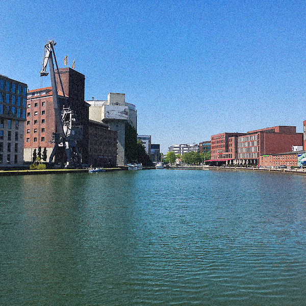
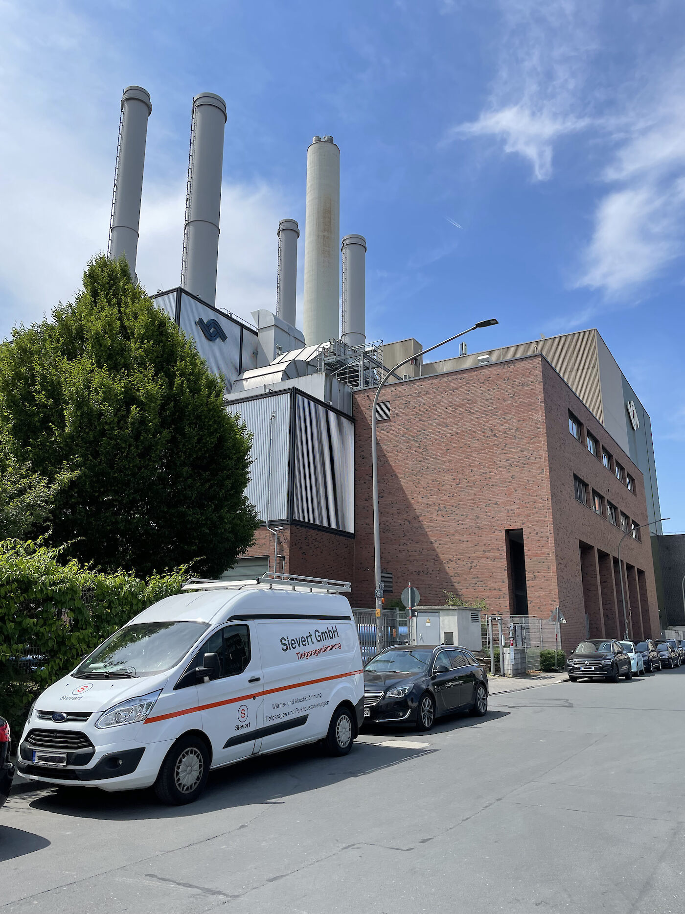
With the establishment of the port in 1898, the city of Münster developed an important economic sector.3 In 1901, the first power plant in Münster was built in the port, which was able to supply the new railroad with electricity.4 These investments ensured that the port of Münster became an important location for transshipment trade in Westphalia. However, this boom decreased due to the First World War. In 1923, the port was able to recover from the downturn as it benefited from the occupation of the Ruhr region. As a result, goods could be delivered to Münster by ship and then transported onward to the Ruhr region by rail. The port experienced a further upswing in 1926, as it opened to tourism. Two cruise ships were stationed in the harbor basin.3 During World War II, 63% of Münster's urban area was destroyed and the city embarked on a major reconstruction effort.5 In March 1946, the port was able to reopen. In 1953, Stadtwerke Münster was entrusted with port management, which ensured that the port reached its economic peak in the 1960s. In this period, up to 4,300 ships entered and left the port annually.6 In the course of the 1970s, two competing company harbors settled around Münster, causing an economic downturn of the city harbor. In 1977, Stadtwerke Münster responded by building a coal-fired power plant, which was ultimately the only one to generate an economic plus 6. As a result, the city administration began to consider redesigning the port area in 1996.7 It was a period when several other major projects were implemented, such as the City Library (1993), the Diocesan Library (2005), and the Stubengasse Shopping Center (awarded the German Urban Development Prize in 2010 and the State Prize for Integrated Urban Development in 2012).2 The industrial activity in the harbor sharply declined in 2005, when the power plant was converted to gas and the main customer for port goods disappeared. In 2012, a cargo ship docked at the port for the last time.5 The neighborhood entered a process of revitalization during which the harbor acquired a new character. Relics that still remind us of the port's industrial era are the listed Flechtheimspeicher from 1900, and the old industrial crane from 1962.8 Once an administrative and industrial city, Münster is now considered a hub for business, science and services.2


Spatial program
The boundaries of the Hansa district are clearly defined in spatial terms. The northern boundary is formed by Wollbeckerstrasse. To the east, the Dortmund-Ems Canal is a difficult border to cross, while to the south, the wide and busy Albersloher Weg is a considerable barrier. To the west, Hansaviertel is constrained by the railroad tracks and the main station.
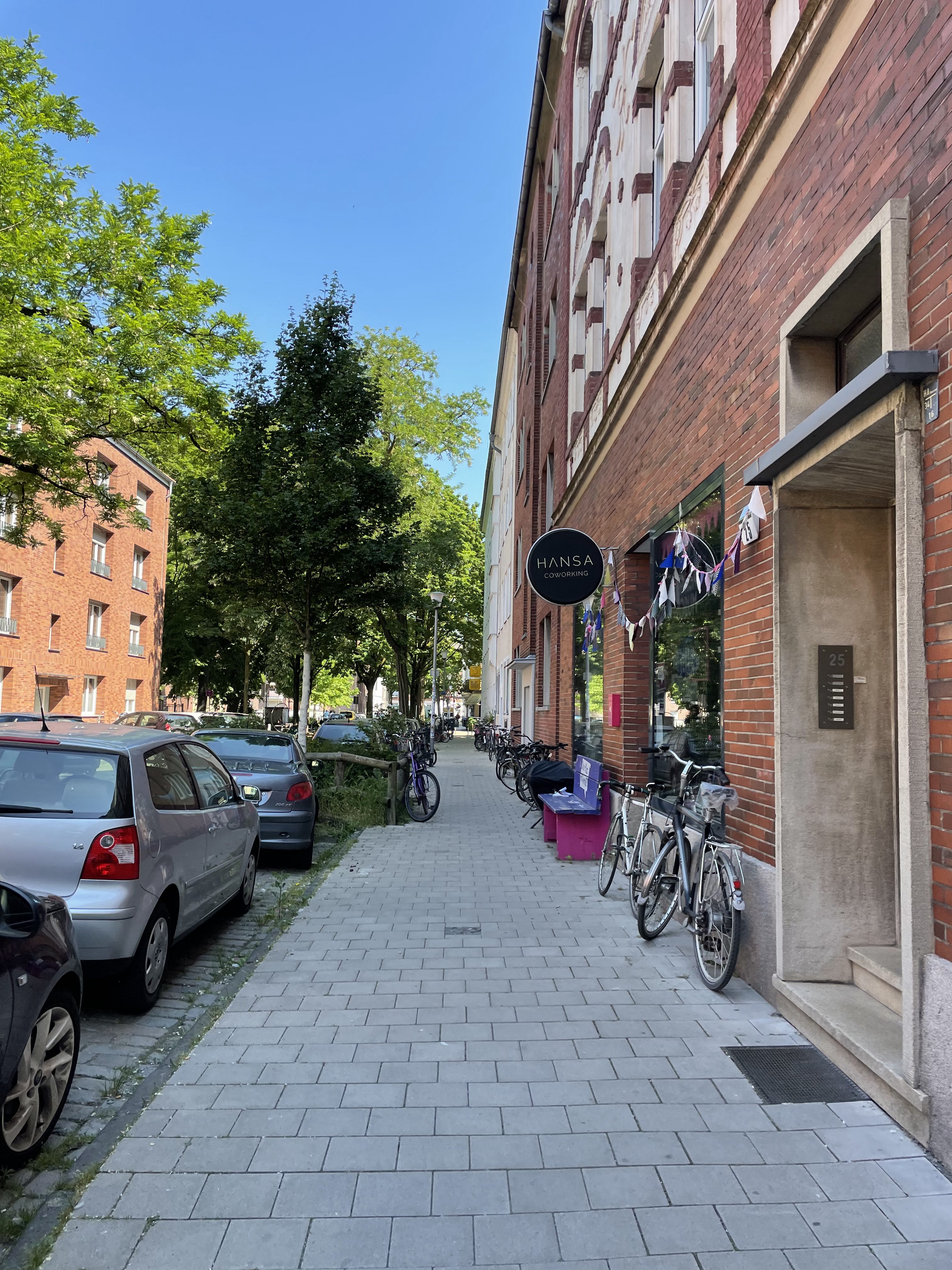
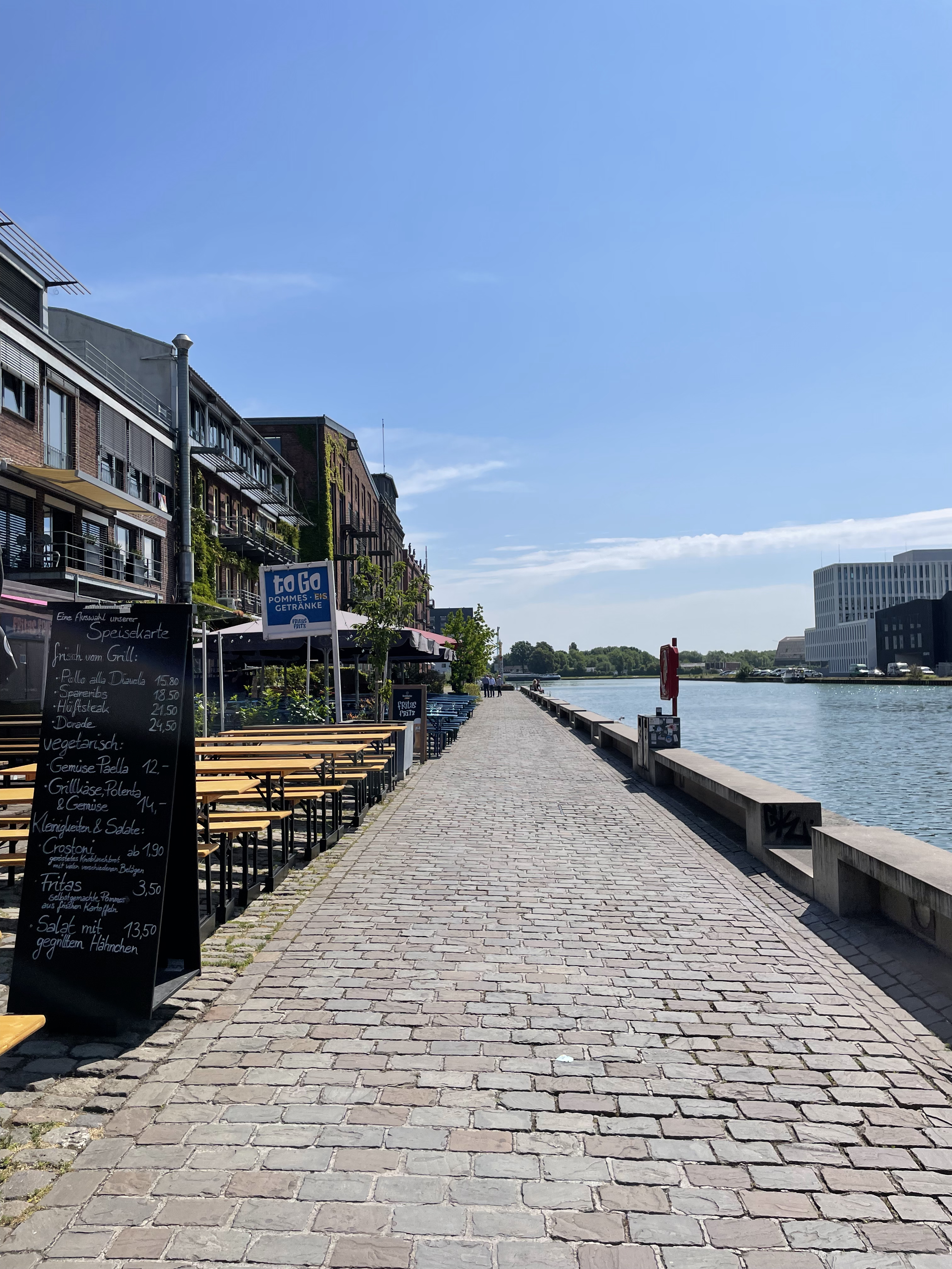
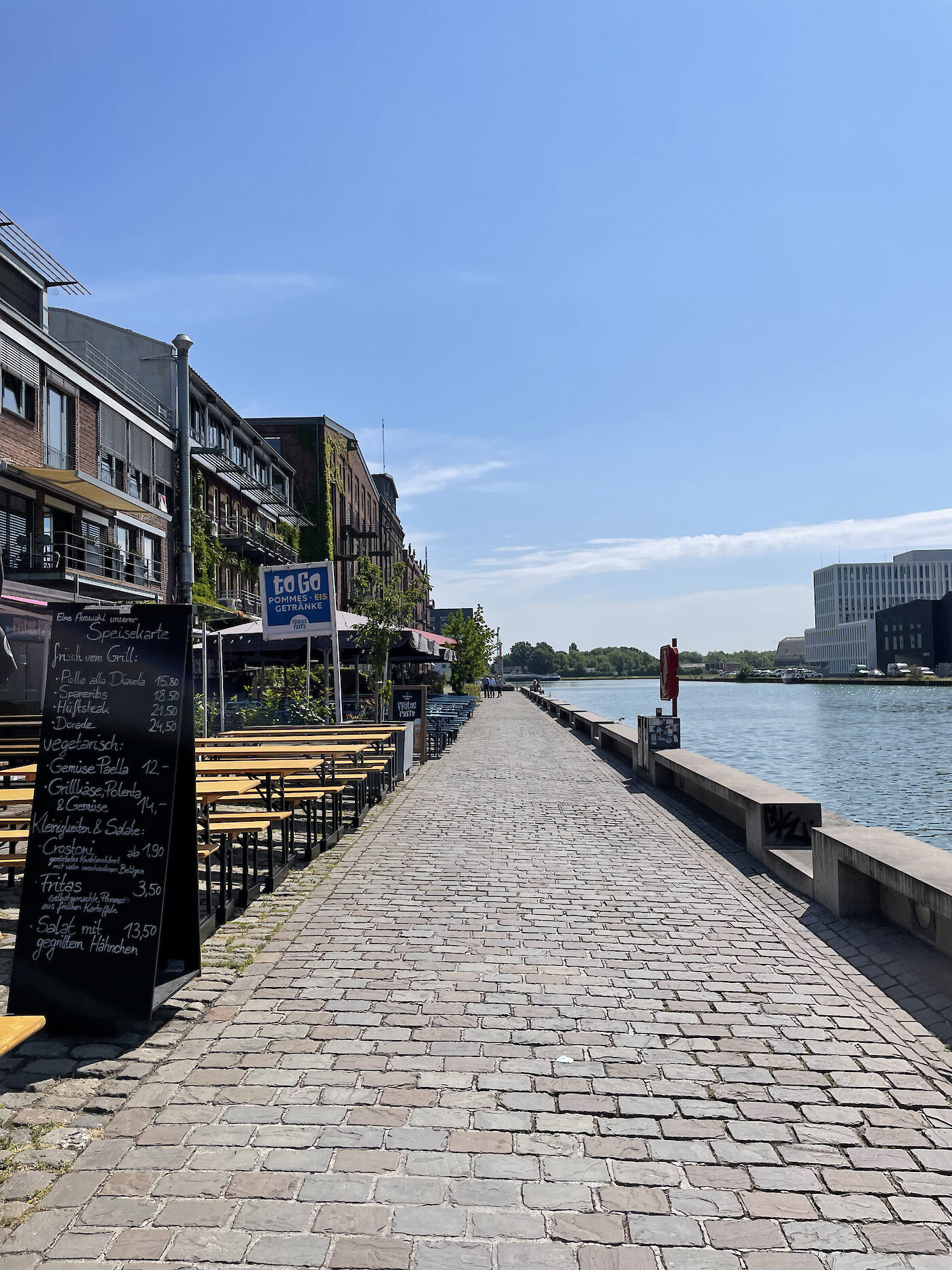
The spatial fabric within Hansaviertel reflects three main functions: Residential, entertainment-oriented commercial and industrial.9 Along Wollbeckerstrasse in the north, are restaurants and a variety of service businesses. South of Wollbeckerstrasse are predominantly apartment blocks with three- to four-story apartment buildings, which occasionally include cafés and bars on the first floor. The first-floor zones of the Hansaring are used by gastronomy. The harbor basin forms the border between industrial and residential zones. Along the northern promenade of the harbor basin, gastronomy and other commercial uses extend over almost all floors of the up to 22m high buildings. The facades of these contemporary buildings are vibrant and diverse. The southern promenade of the harbor basin stands out in comparison to the northern side because the high industrial buildings are partly combined with entertainment-oriented commercial facilities.
The industrial area extends from the harbor basin to Albersloherweg in the south. With the exception of the buildings on the harbor basin, the industrial buildings are rarely used for public purposes.
This was not always the case in the Hansaviertel; after turnover in the port had declined sharply since the 1970s, the share of industry decreased steadily. Starting in the 1980s, Münster's ‘creative scene’ discovered the area for itself, and artists’ studios, architecture and design offices settled there.107 The location was still in demand due to good accessibility and its central position in the city. The municipality began developing the area in 1996, after the expiration of ground leases. In 1997, the decision was made to create the ‘Kreativkai’ model for the transformation of the area.10 Under the name ‘Renewal Focus Southeast’, the port area, which covers a total of 75 hectares, was to be transformed into a mixed-use area.7 This concept was updated several times over the years. In 2004, the ‘Integrated Action Concept for Münster City Harbors’ was created, which was further developed in 2012 as the "Münster City Harbor Master Plan". As a result of the revitalization of the area, 220 companies (as of 2017) are located there, most of them from the creative sector.7 Furthermore, retail, gastronomy, trade as well as companies from the financial sector can be found on site. These new settlements shaped the mixed-use concept in the neighborhood today.7


Mobility and Infrastructure
In terms of mobility, Münster has established itself as a leading example of a cycling prioritizing city. It has even been voted as ‘Germany’s most bicycle friendly city’ by the German Cyclists’ Federation. This is possible due to the infrastructure that accommodates cyclers; the Münsterland cycling network covers 4,500 kilometers.11 According to a mobility survey conducted by the city, bicycle transportation was reported to take 47% of the traffic share, while car traffic counted for only 29% decreasing from 34% in 2019.12
Building on this carbon-emission free mode of transportation, the city is developing the Mobility Master Plan Münster 2035+ with the aim of climate neutral transportation. Participation plays an important role in this case as labs and public discussions were encouraged to involve the residents.13 However, the plan is not challenge-free. While the current situation is regarded as positive, further improvements can be difficult to accomplish. For instance, the street space is too limited to allow for further bicycle infrastructure.14
Zooming into the area in focus, one can observe that it went through several stages until it reached its current day image. Until the 1970s, the area adjacent to the harbor basin was strongly characterized by industry, which is also reflected in the infrastructure and mobility.6 Cargo ship traffic across the canal and in the harbor basin is a defining feature. In addition, there was a tram line that ran through the Hansaviertel until 1948. At first it was named the ‘Green Line’. It was discontinued due to inefficiency, and the section of the line through the quarter from the train station to Albersloher Weg was taken over by the ‘Red Line’.15 At the harbor, there was also the carriage hall for the streetcars, which burned down during the Second World War.16 Currently, Wolbecker Strasse and Albersloher Weg are considered to be the two main roads in the area. They are arterial roads connecting the city center to the east and southeast parts of the city.17 They also have the highest concentration of bus stops.
Albersloher Weg is the street that witnesses the most car traffic. This fact is not only present in data and the visual image of the street, but also its acoustic perception. The wide range of characters in the area is visible in terms of mobility as well. Albersloher Weg has loud car noises, this is a contrast to streets like Meppener Str. and Hamburger Str. which offer themselves as more quiet and less crowded.
Additionally, Albersloher Weg is part of the city’s large Veloroute project18, which aims to connect the inner city to its outskirts with a safe cycling path, thereby establishing cycling as a viable method for long-distance transportation. The street is one of the 14 streets taking part in this transformation. The other street within the area included in this scheme is Schiller Str., located within the city ring. Another strong aspect of the cycling infrastructure is the saturation of bike rental facilities; within the area alone, there are three rental locations: Hafenweg 16, Dortmunder Str. 19, and Hansaring 59-65.


Public space
The entire area has undergone a remarkable transformation, evolving from its industrial roots into a vibrant public open space. The harbor square, established in 199710, marks the gateway to this revitalized zone and hosts city events such as the harbor festival and beach volleyball tournaments.1920 In terms of design, the square pays homage to its industrial past through the integration of old rail elements, which not only evoke the area's history but also seamlessly connect the south and north promenades of the harbor basin, creating a cohesive landscape. The northern promenade, known as 'Kreativkai', is a vital hub of public life where people of all ages gather, whether by the basin's edge or at one of the many culinary establishments. The southern promenade features an old industrial crane, serving as a poignant reminder of the area's historical industrial use. The southern area adjacent to the harbor remains commercially focused, lacking public spaces or green areas. In contrast, the northern vicinity of the harbor has numerous playgrounds, green spaces, and city squares. Bremer Platz, located directly at the back of the main train station, forms the northeastern entrance to the Hansaviertel. In the area's center are the playgrounds Elisabeth-Kirchplatz and Hansaplatz. The former is mainly used by kindergartens or families with younger children, and is sheltered in the residential area. The latter is more diverse and appeals to different age groups. There is a playground, a large sports field, and a multifunctional area. However, the atmosphere is not as comfortable due to its direct location at the intersection of Hansaring and Wollbeckerstrasse. Additionally, persons experiencing homelessness stay in certain spots of the square. Despite all this, Hansaplatz is known for being used for events such as the neighborhood festival.21
Hubertiplatz forms a focal point for residents in the western part of the residential area from a combination of square, playground, and sports field. It is located on side streets and has a rich tree stand, which improves the atmosphere of the square. Both Hansaplatz and Hubertiplatz stand out in the cityscape because of their size. Each forms an entire block in the area. In addition, the Memelufer on the Dortmund-Ems Canal provides a place with a different character. The waterfront area is composed of a large meadow, a playground, and a parkour park. Due to the diverse and open offer that the waterfront provides, walkers, athletes, and different aged groups share the place. The offer of public open spaces in the northern area is multifaceted. From playgrounds and sports fields to city squares and a green and urban promenade with restaurants, the Hansaviertel has a lot to offer.


Participation
Hansaforum, an initiative that supports the residents in shaping the neighborhood in a democratic manner, contributed majorly to the transformation of Hansaviertel.22 The project was funded by the ‘Federal Office for Building and Regional Planning’ with 700,000 euro from 2019 to 2021 and has implemented around 80 projects.23 The main component of the democratic process was the initiated Hansa congress. In this forum, randomly selected citizens jointly developed a ‘Neighborhood Community Wellbeing Index’. This index deals with all issues that, according to the committee, promote the common good in the neighborhood. It represents an unprecedented development in this area.22 Relevant topics are for example networking or climate positivity. In total, about 400 people participated in the ‘Neighborhood Community Wellbeing Index’.22 Based on its topics, all citizens could then propose projects. If the projects corresponded to the ‘Neighborhood Community Wellbeing Index’ and were approved by the committee, they received funding from the funding pot. The index was constantly developed further in the course of the funding at the congress.23 For example, a raised flower bed was funded, which is low enough to enable children to garden actively.24 Another integrative example describes the project as 'Listening instead of looking away - Münster's forgotten voices', in which a podcast becomes a platform for homeless people in the neighborhood.25 The offer to submit projects was open to all citizens. Hansaforum tried to reach all people as easily as possible through its website. However, this is unfortunately only available in German, which limits the circle of participants. Many young adults were and are still active in the Hansaforum, but families and older people also participated in the projects. The responsible organization for the Hansaforum project is called B-Side, which continues to actively work to ensure that citizen engagement has a further democratic impact on the shaping of the neighborhood. Ultimately, the slogan remains: "Make the city instead of letting it be made".23

Gentrification
When talking about urban development processes in the city of Münster, the word 'gentrification' is often mentioned. The Hansaviertel is also mentioned in this regard.28 The change in the population structure was a result of de-industrialization and the development concepts from 1997 to 2012. Because of its proximity to the city center, the municipality encouraged residential construction in the neighborhood and workers from the industry moved out.7 Large-scale projects, which were implemented over the course of this period, are considered to be the catalyst of the gentrification process. In these projects, the creative character of the neighborhood was particularly promoted. As a result, other businesses and especially bars and clubs settled in the Hansaviertel, whose number increased over the years. The residents at the time complained, due to the low participation of the population.7 In the meantime, various statistics show that the resident composition witnessed a drastic change. Overall, more than 50% of the residents have lived in the Hansaviertel for less than five years in 2020. Compared to the rest of Münster, this proportion of new residents is very high.2627 In addition, the participation process in the course of the Hansaforum plays an ambivalent role. On one hand, increased financial resources and greater civic engagement are enriching the neighborhood, suggesting a rationale for rent increases amidst ongoing improvements. Conversely, members of the Hansaforum acknowledge gentrification and endeavor to address it through a vision that aims to preserve inclusivity within the Hansaviertel community.31 The city of Münster has reacted to the gentrification process with a social preservation statute, which was implemented in 2021. The residential area above the harbor basin is to be placed under 'milieu protection'. This means that new construction and visible alteration of the buildings is not allowed without permission. Regulating construction prevents drastic rent increases which in turn protects the composition of the population which may have otherwise not been able to afford new prices.30 The implementation of the social preservation statute was reviewed in 2022. In the period of one year, only one judicial proceeding was started, in which a resident has not complied with the regulations. The social preservation statute is evaluated every five years and checked for their suitability.32 Moreover, in a major project on the waterfront, the city specified that 30% of the housing must be used as socially subsidized housing.29 Over time, numerous stakeholders have engaged with the issue of gentrification and are working to mitigate its effects.
The unpredictable future of Hansaviertel
The Hansaviertel transformation takes place in a city with a radiant image of historical importance, advanced mobility practices and renowned high education. While many post industrial landscapes fall into an undefined existence, the harbor was rescued from this fate through a powerful planning strategy that was conscious enough to include the residents and provide them with a platform to voice their opinions. Today, it is a must-see spot for visitors and residents who enjoy spending their leisure time in a trendy yet relaxed environment. Its success at morphing into a space for people after once being a space for machines is undeniable. Overall, urban redevelopment positively impacts public life, the quality of spaces, economy and culture. Yet, its accompanying downfalls -i.e. gentrification- must be also noted in order to figure out an equitable scheme for urban transformation. Can the Hansaviertel become a catalyst for an urban utopia free of gentrification?
Autor*innen
Quellen
- Stadt Münster. Zahlen, Daten, Fakten für Münster. https://www.stadt-muenster.de/statistik-stadtforschung/zahlen-daten-fakten, 30.06.2023
- Stadt Münster. Young old city. https://www.stadt-muenster.de/english/ten-times-muenster-in-brief/young-old-city, 19.07.2023
- Stadtwerke Münster. Hafen-Geschichte: Die Anfänge des Stadthafens. https://www.stadtwerke-muenster.de/blog/stadtwerke/hafengeschichte-die-anfaenge-des-stadthafens/, 15.10.2018
- Stadtwerke Münster. Wie der Strom nach Münster kam. https://www.stadtwerke-muenster.de/blog/energie/wie-der-strom-nach-muenster-kam/, 06.04.2021
- Stadt Münster. Town history. https://www.stadt-muenster.de/en/tourismus/peace-of-westphalia/town-history/1900-to-1945, 19.07.2023
- Stadtwerke Münster. Als der Hafen noch Industriegebiet war. https://www.stadtwerke-muenster.de/blog/stadtwerke/als-der-hafen-noch-industriegebiet-war/, 01.08.2018
- LWL. Waterfront Redevelopment in Münster: Vom Stadthafen zum Kreativkai. https://www.westfalen-regional.de/de/waterfront_redevelopment/, 23.12.2019
- Stadtwerke Münster. Diese 7 Hafen-Geheimnisse kanntest du noch nicht. https://www.stadtwerke-muenster.de/blog/stadtwerke/diese-7-fakten-ueber-den-hafen-kanntest-du-noch-nicht/, 20.01.2020
- Stadt Münster: Planen und Bauen. Flächennutzungsplan der Stadt Münster. https://geo.stadt-muenster.de/webgis/application/PlanenUndBauen?visiblelayers=1145/20146,1145/20147.%20Zuletzt%20aufgerufen%20am%2013.06.2023, 19.07.2023
- Nationale Stadtentwicklungspolitik: Nationale Stadtentwicklungspolitik. Münster-Hafenviertel „Kreativkai“. https://www.nationale-stadtentwicklungspolitik.de/NSP/SharedDocs/Projekte/WSProjekte_DE/Muenster_Hafenviertel_Kreativkai.html, 17.06.2014
- Stadt Münster. Germany’s cycling capital. https://www.stadt-muenster.de/english/ten-times-muenster-in-brief/germanys-cycling-capital.html, 19.07.2023
- Mobilitätsbefragung 2022 Zum werktäglichen Verkehrsverhalten der Bevölkerung in Münster. Kurzbericht, S. 26, Aachen 17.05.2023
- Klimadiskurs NRW. Der Masterplan Mobilität Münster 2035+. https://klimadiskurs-nrw.de/der-masterplan-mobilitaet-muenster-2035/, 19.07.2023
- Zwischenbericht zum Masterplan Mobilität Münster 2035+, Ergebnisse der Bestandsanalyse, S.54-63, Düsseldorf / Berlin / Karlsruhe 20.01.2022
- Stadtwerke Münster. Blick zurück auf die ersten Straßenbahnen: So sah Münsters Nahverkehr vor 120 Jahren aus. https://www.stadtwerke-muenster.de/blog/verkehr/blick-zurueck-auf-die-ersten-strassenbahnen-so-sah-muensters-nahverkehr-vor-120-jahren-aus/, 02.04.2020
- Stadtmuseum. Münster im Modell. Münster 1934 Detail 1. https://www.stadt-muenster.de/museum/museum/muenster-im-modell/hafen-1934/hafen-1934-detail-1/wagenhalle-fuer-die-elektrische-strassenbahn, 23.06.2023
- Münster-Hansaviertel. Verkehr. https://de.wikipedia.org/wiki/Münster-Hansaviertel, 19.07.2023
- Velo Route. Alle Velorouten im Überblick. Wo und wie verlaufen die Velorouten?. https://www.veloregion.de/routen/, 19.07.2023
- Münster Hafenfest. https://ms-hafenfest.de/, 12.07.2023
- Beachvolleyball: German-Beach-Cup. Münster freut sich auf Sandkastenspiele an neuem Standort. Westfälische Nachrichten. https://www.wn.de/sport/lokalsport/muenster/muenster-beachvolleyball-turnier-german-beach-tour-hafen-2553919?npg=, 05.04.2022
- Nachbarschaftsfest auf dem Hafenplatz.. https://hansaforum-muenster.de/projekte/nachbarschaftsfest-auf-dem-hansaplatz/, 23.06.2023
- Quartier-Gemeinwohl-Index Wie wir Gemeinwohl gemeinsam bestimmen können, S. 1-29, 54, Münster 06.2022
- Schopp, Lisa (Hg.): Bundesinstitut für Bau-, Stadt- und Raumforschung: Stadt gemeinsam gestalten! Neue Modelle der Koproduktion im Quartier, S. 148, 151, 169, Bonn 08.2021
- Grüninsel 4kids. https://hansaforum-muenster.de/projekte/grueninsel-4kids/, 19.07.2023
- Zuhören statt wegschauen – Münsters vergessene Stimmen. https://hansaforum-muenster.de/projekte/zuhoeren-statt-wegschauen-muensters-vergessene-stimmen/, 19.07.2023
- Stadt Münster: Stadtteilsteckbrief 2020. 44 Herz-Jesu. Münster, S. 16, Münster 01.2022
- Stadt Münster: Stadtteilsteckbrief 2020. 24 Hansaplatz. Münster, S. 16, 01.2022
- LWL. Gentrification in innenstadtnahen Wohnquartieren: Das Kreuzviertel in Münster. https://www.westfalen-regional.de/de/gentrification/, 01.01.2007
- Grünes Licht für Stadtquartier. Verwaltung legt Verhandlungsergebnisse vor / 690 Wohneinheiten entstehen am Stadthafen Nord. PM: Alles Münster online Magazin. https://www.allesmuenster.de/gruenes-licht-fuer-stadtquartier-im-stadthafen-nord/, 28.02.2020
- Soziale Erhaltungssatzung Hafen-, Hansa- und Herz-Jesu-Viertel, S. 3-6, Münster 2022
- draussen! Münster. Wie das Hansaforum den Wandel im Hansaviertel vorantreibt. https://strassenmagazin-draussen.de/wie-das-hansaforum-den-wandel-im-hansaviertel-vorantreibt/, 19.07.2023
- „Öffentliche Berichtsvorlage“. In: Vollzug der Sozialen Erhaltungssatzung Hafen-, Hansa-, Herz-Jesu-Viertel - Erster Sachstandsbericht, V/0801/2022, Münster 27.01.2023